
Map & Directions
The 2026 Pikes Peak Regional Airshow is held at 7330 Embraer Heights, Colorado Springs, Colorado. This is the same address as the U.S. Army A/DACG Facility at the far south end of Colorado Springs Airport.
Once you are close to the airshow, follow signs and law enforcement instructions to route you to the closest available parking lot. You will need to walk to the show entrance from there.
South Bound Markscheffel
- Head South on Marscheffel
- Take a Right onto Bradley Rd and continue west
- Take a right onto CO-21 N (Powers Blvd)
- Turn Right onto Peak Innovation Pkwy
- Continue North and Follow event parking signs and attendants
North/South Bound I-25:
- Continue on I-25
- Take Exit 132 towards Mesa Ridge Pkwy
- Continue Straight onto CO-21 N (Powers Blvd)
- Turn Right onto Peak Innovation Pkwy
- Continue North and Follow event parking signs and attendants
Southbound Powers:
- Head South on Powers
- Continue South and take a left onto Grinnell Blvd
- Follow Event parking signs and attendants
Closure Map
Click here to view a map of safety closures during the airshow. This may affect available routes into, and out of the airshow.
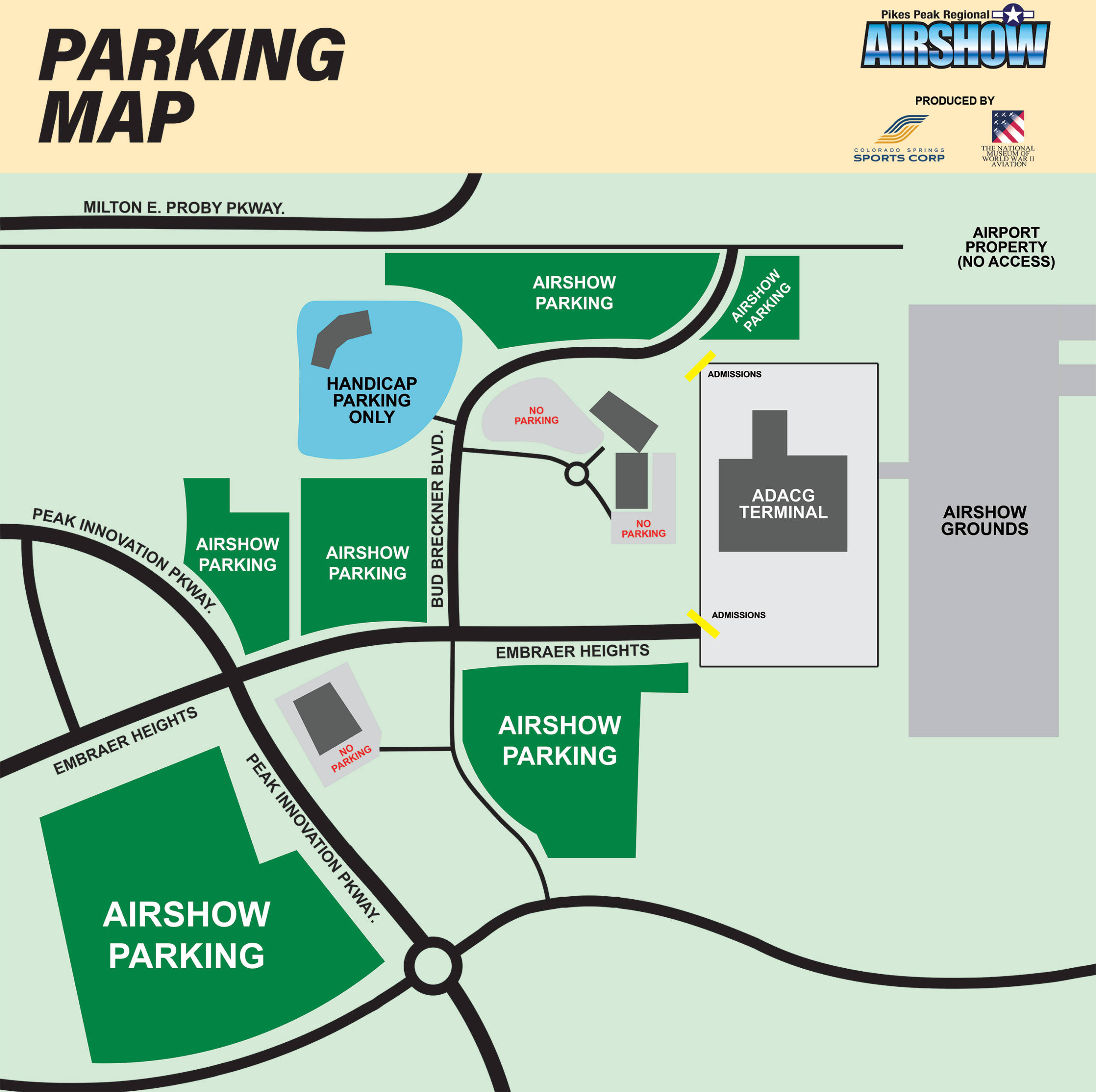
Parking Map
Click here to view a map of parking lots available at the 2026 Pikes Peak Regional Airshow. This will help locate handicap parking, and entrances.
Seating & Grounds Map
Click here to view the seating map once you have entered the Airshow. This will help locate vendors, static aircraft, and premium seating areas.